Air Quality
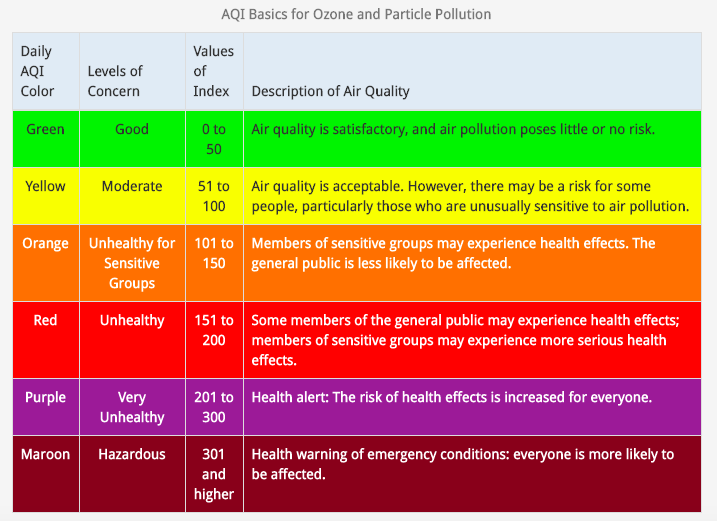
The air quality index, or AQI, is a calculation based on a given air pollutant and its concentration over a period of time. Considered pollutants include ground-level ozone, particulate matter, carbon monoxide, sulfur dioxide, and nitrogen dioxide; AQI is calculated from the highest pollutant concentration. The index ranges from 0 to 500 with bands for: good, moderate, unhealthy for sensitive groups, unhealthy, very unhealthy, and hazardous.
Monitoring Resources
AirNow
The EPA maintains a network of calibrated air monitoring stations across the country, including Santa Cruz County. Official air quality ratings and information can be found on their website, www.airnow.gov
Fire and Smoke Map
A dynamic map detailing regional fire activities and smoke impacts is available through the AirNow site. Santa Cruz area map.
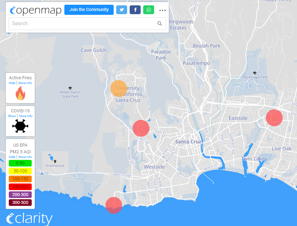
Clarity
Additional air monitoring devices have been installed on campus utilizing equipment from Clarity. Current air quality readings can be located on their interactive map, https://openmap.clarity.io/
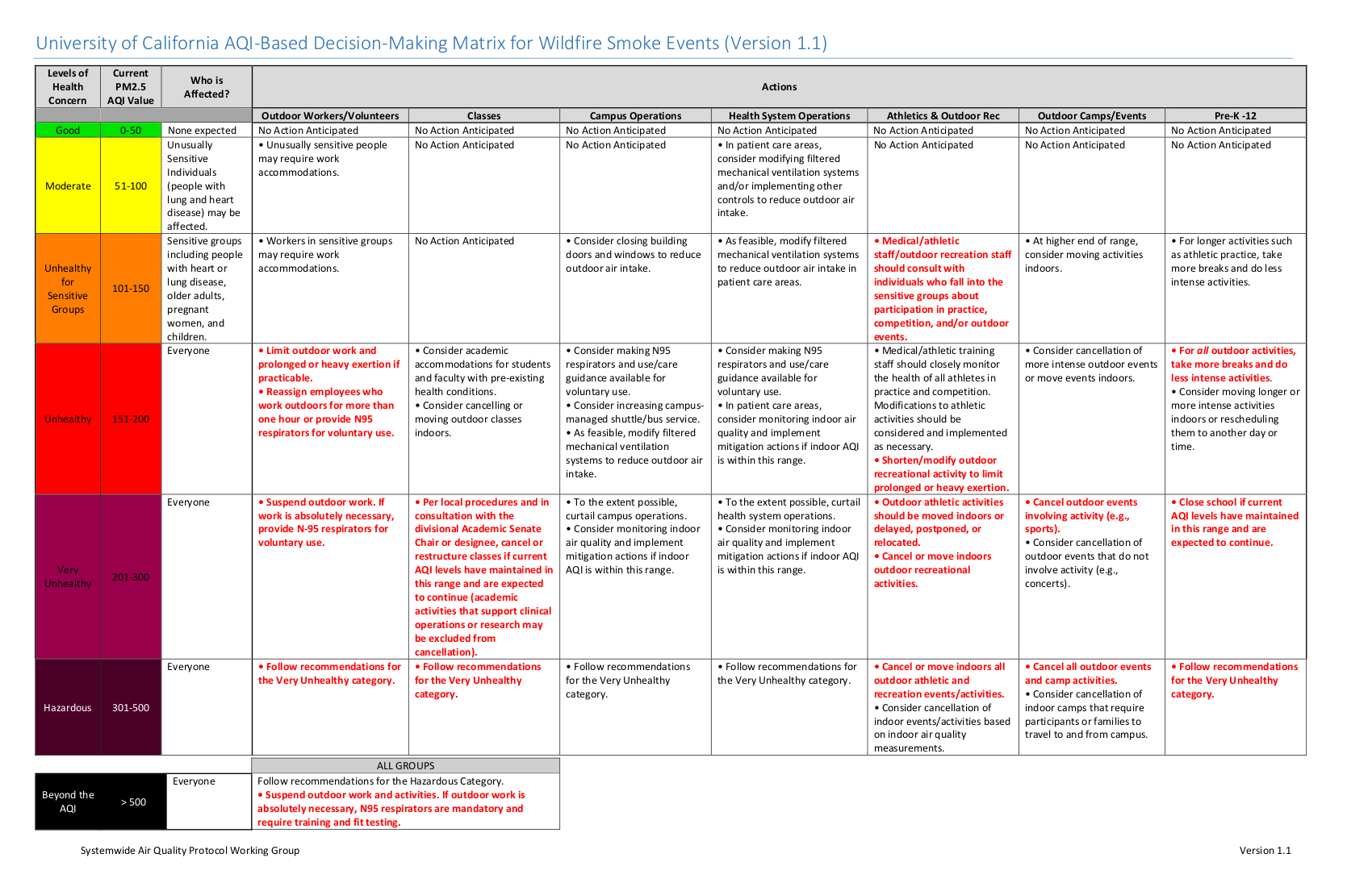
Campus Actions Depending on AQI
During the 2019 wildfire season air quality at several UC campuses reached concerning levels and prompted a number of activities to be modified or canceled. These action points have been unified into a systemwide decision matrix.