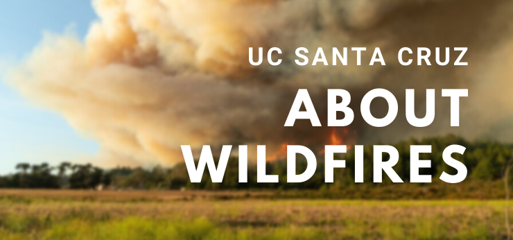
About Wildfires
What is a Wildfire?
A wildfire is an uncontrolled fire originating in rural areas that spreads quickly through vegetation and any available fuel. Their behavior can vary drastically through conditions such as dry vegetation, humidity, topography, and wind.
On August 16th, 2020, a thunderstorm composed largely of dry lightning ignited 24 small fires in San Mateo and Santa Cruz counties. These fires, combined with intense wind conditions, formed the CZU Lightning Complex fires. At maximum, the CZU fires spread as far South as Bonny Doon, only a few miles away from the UC Santa Cruz Main Campus. On August 20th, the decision was made to fully evacuate the campus. After a few days of careful monitoring alongside California Department of Forestry and Prevention (CalFire), the risk to campus was deemed low and people were brought back to campus in phases beginning August 25th.
On August 18th, 2020, that same thunderstorm ignited what would become the SCU Lightning Complex fires. Although much further away from the main campus, the fires did affect the UC-managed Lick Observatory in the mountains near San Jose, CA.
Also on August 18th, 2020, a suspected arsonist ignited the Dolan Fire, affecting UC Santa Cruz’s Big Creek Reserve in Monterey County.
In combination, these three fires accounted for over 600,000 acres burned and thousands of buildings damaged or destroyed. They represent only a portion of the increasing proliferation of wildfires in the Western United States. The CZU Lightning Complex fires marked the first time in UC Santa Cruz history that the campus was evacuated.
Santa Cruz County is no stranger to wildfires, but they have certainly increased in intensity and spread in recent years. Below is a table that illustrates wildfires affecting the county since 1954. Prior to the 1950s, historical records of wildfires become sparse for Santa Cruz County.
|
Year |
Fire Name |
Acres Burned |
|
1954 |
CZU Newell Creek |
166 |
|
1959 |
CZU Newell Creek #2 |
1325 |
|
1961 |
SCU Austrian Gulch |
45 |
|
1962 |
CZU Lincoln Hill |
1355 |
|
1980 |
CZU Big Basin #7 |
377 |
|
1984 |
CZU Rocha VMP Escape #2 |
1168 |
|
1985 |
SCU Lexington |
736 |
|
2002 |
SCU Croy |
15 |
|
2008 |
CZU Castle |
19 |
|
2008 |
CZU Martin |
482 |
|
2008 |
SCU Summit |
3878 |
|
2008 |
CZU Trabing |
594 |
|
2009 |
CZU Lockheed |
7783 |
|
2009 |
CZU Loma |
669 |
|
2016 |
SCU Loma |
8 |
|
2017 |
CZU Bear |
317 |
|
2018 |
CZU Bear |
317 |
|
2018 |
CZU Rincon |
15 |
|
2019 |
CZU Deer |
9 |
|
2020 |
CZU Lightning |
63668 |
The Wildfire Lifecycle
Wildfires follow a basic life cycle that includes ignition, growth, management, and extinguishment. Each stage is described below. It is important to note that the recipe for a fire is relatively simple, all that is needed is fuel, oxygen, and heat. Every other variable or condition can make a wildfire more likely or more dangerous, but the wildfire itself follows a simple structure.
- Ignition - Since oxygen is present all around us, the primary needs for a wildfire are fuel and heat. This can include embers from burning debris, cigarette butts, unattended campfires, arson, and lightning strikes. If dry vegetation surrounds this ignition source, it can quickly catch fire and move to the next stage.
- Growth - The chief component of a wildfire’s danger is its growth. A wildfire will quickly consume dry vegetation and spread to anything nearby that will burn. This could be more dead vegetation, trees, debris, or flammable structures like homes. A wildfire’s growth is one of the most challenging aspects to predict, monitor, and combat.
- Management - This refers to everything that firefighters do to combat the spread of the wildfire. It includes using water and flame retardant to make it harder for the fire to find oxygen and fuel to continue growth. It also includes using resources like fire breaks and control lines to create areas where there is no fuel for the wildfire to expand to.
- Extinguishment - A wildfire is considered fully contained when the entire perimeter of the fire is surrounded by a control line where the fire cannot spread to nearby fuel. At the same time, any unburnt fuel within the control line is removed and remaining flames are subdued until there are no detected flames within the control lines.
Wildland Fires and Prescribed Burns
To put it succinctly, all wildfires are wildland fires but not all wildland fires are wildfires. ‘Wildland fires’ is a broader term that includes purposeful, controlled fires such as prescribed burns. When fire officials can safely control environmental variables and minimize the danger of a fire getting out of control, they will initiate a prescribed burn to accomplish one or more of the following goals:
- Creating diverse habitats for plants and animals.
- Assist in the recovery of endangered species.
- Vegetation management and wildfire prevention.
Forests have evolved to include wildfires as a part of their lifecycle. Numerous species can only thrive when a fire occurs by clearing out dead organic matter and increasing soil fertility. Additionally, the controlled nature of prescribed burns allows for the risk of larger fires to be minimized by restricting their fuels.
Further Reading:
- National Geographic, The Ecological Benefits of Fire
- National Park Service, What is a Prescribed Fire
Spot Fires
The Wildland-Urban Interface
UC Santa Cruz exists in the Wildland-Urban Interface (WUI), a designation for areas that connect largely undeveloped land full of vegetation to more developed areas where people live and work. WUI areas nationwide are growing at a rate of approximately 2 million acres a year as human development continues. A WUI area has an elevated risk of wildfires due to its proximity to the fuels that allow a wildfire to proliferate. Considering any increase in risk to wildfires is a core component of any plans to further develop UC Santa Cruz.
Air Quality
Wildfires are closely associated with acute air quality concerns. Wildfires spew complex mixtures of gases and particles into the atmosphere that can travel thousands of kilometers. The primary concern with respect to wildfires are PM2.5, or particles that have a diameter of less than 2.5 micrometers. These particles in particular are easy to get into the eyes/lungs, and stay in the air for longer periods of time after being generated.
Air Quality is measured using the Air Quality Index (AQI) which combines measurements of pollutants in the air including ground-level ozone, particle pollution, carbon monoxide, and sulfur dioxide. The Environmental Protection Agency (EPA) measures the AQI using stations across the United States, including in Santa Cruz. The UCSC Environmental Health and Safety department also maintains an additional monitoring station on campus.
On the right you will find a constantly updated widget showing the current AQI for Santa Cruz, California. Below you will find a chart indicating what the various AQI readings mean.
|
Color Rating |
Level of Concern |
Index Values |
Air Quality Description |
|
Green |
Good |
0 - 50 |
Air quality is satisfactory and air pollution poses little to no risk. |
|
Yellow |
Moderate |
51 - 100 |
Air quality is acceptable. However, there may be a risk for some people, particularly those who are unusually sensitive to air pollution. |
|
Orange |
Unhealthy for Sensitive Groups |
101 - 150 |
Members of sensitive groups may experience health effects. The general public is less likely to be affected. |
|
Red |
Unhealthy |
151 - 200 |
Some members of the general public may experience health effects. Members of sensitive groups may experience more serious health effects. |
|
Purple |
Very Unhealthy |
201 - 300 |
Health Alert: The risk of health effects is increased for everyone. |
|
Maroon |
Hazardous |
301 and above |
Health Warning of Emergency Conditions: Everyone is more likely to be affected. |
The University of California has implemented a Systemwide AQI-Based Decision Making Matrix with the intent of adapting campus activities based on air quality health considerations for the campus community.
Wildfire Frequency
The frequency of wildfires has been increasing over the past several years. Additionally, the times of the year where a wildfire is likely to occur are expanding. According to CalFire, climate change is a key component of this intensifying trend. Low rainfall, drought, dry vegetation, and reduced snowpack combine with weather conditions such as low relative humidity, high winds, and warm temperatures to create the ideal environment for wildfire spread.
- See the Science: Climate Change and Wildfires
Wildfire Detection and Response
Wildfires are a rapid onset disaster and detecting them early can make an enormous difference in subduing them. A range of tools are used to detect wildfires from wildfire spotters in high-risk areas to weather satellites scanning the land for ‘hot spots’ for fire officials to investigate.
Below you will find an embedded map that overlays information from a National Oceanic and Atmospheric Administration (NOAA) satellite to determine hot spots around the world. Although not every hotspot is indicative of a fire, they can serve as a crucial early warning system to allow firefighting officials to investigate remote areas early in a wildfire’s life cycle.
